Lidar

At Nordgeo Surveys, we provide advanced LiDAR scanning services, ensuring highly accurate spatial data for diverse applications.
This technology enables precise digital models of buildings, infrastructure, industrial sites, and heritage structures with great detail and efficiency.

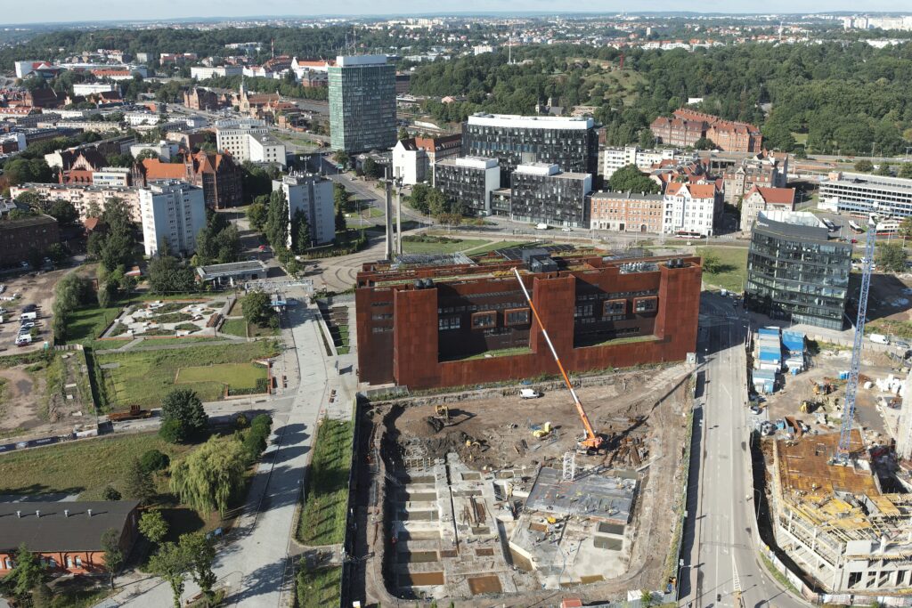
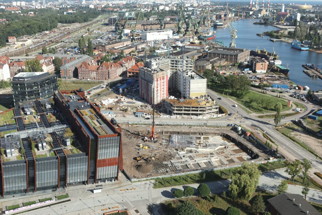
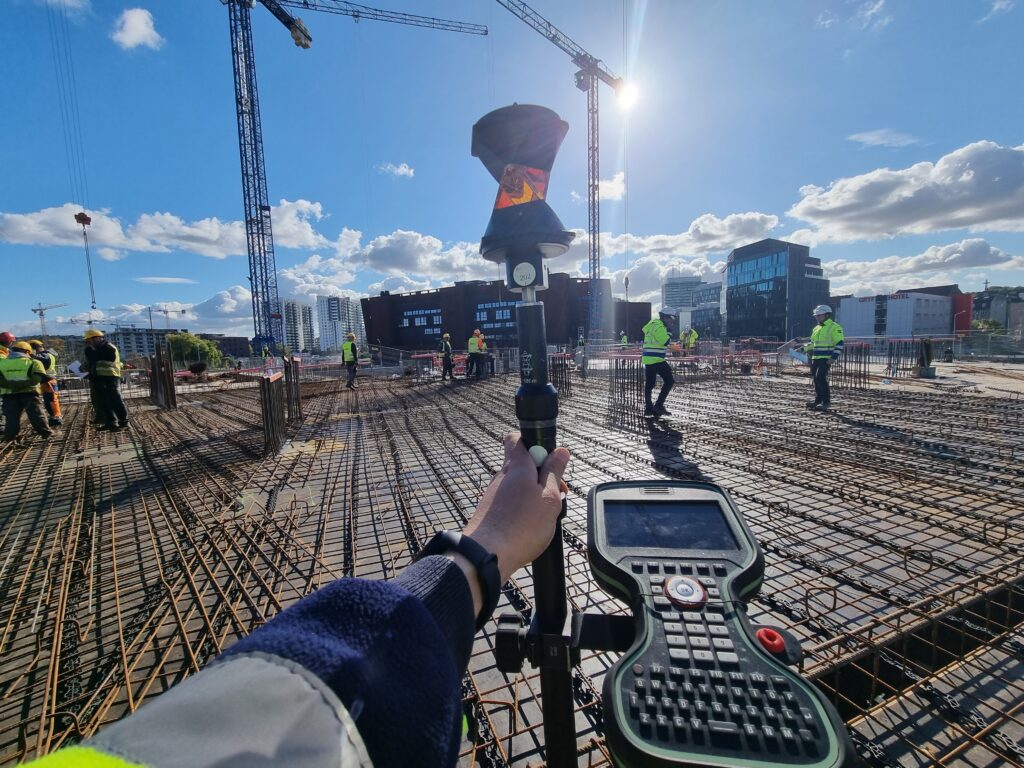
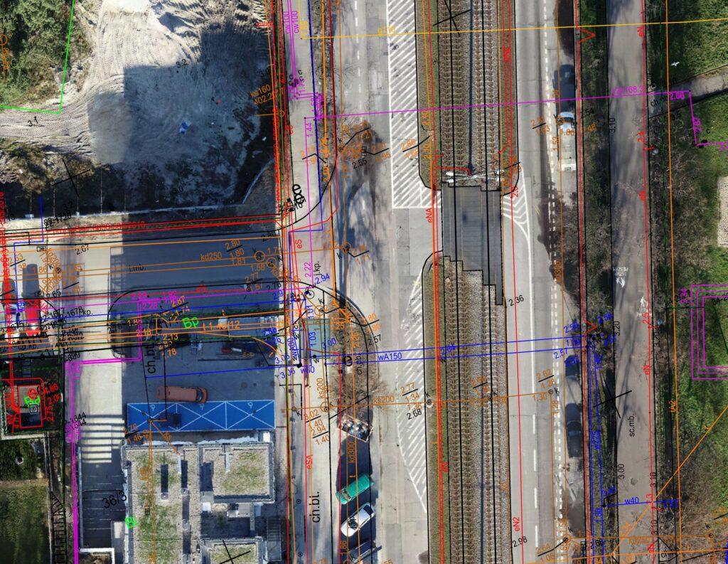
Authorization for Drone Operations in Controlled Airspace under STS-01 and STS-02
We are proud to announce that our company has obtained Operational Authorization from
the Irish Aviation Authority (IAA), allowing us to conduct advanced drone operations under Standard Scenarios STS-01
and STS-02, including operations in Controlled Airspace.
By meeting the stringent requirements of the European Union Aviation Safety Agency (EASA) and IAA, we are authorized to carry out precise measurements, inspections, and monitoring in high-risk areas, ensuring compliance with all regulatory and safety standards.
Our authorization covers:
✔ STS-01 – Operations in urban areas (Visual Line of Sight – VLOS)
✔ STS-02 – Beyond Visual Line of Sight (BVLOS) operations in controlled environments
✔ Controlled Airspace Operations – Conducting missions in airspace regulated by aviation authorities
With cutting-edge technology and the highest safety standards, we deliver accurate and reliable data, even in the most challenging locations.

Partner with Nordgeo Surveys for cutting-edge LiDAR scanning services and experience the future of geospatial data collection
Our expertise and innovative approach ensure precise, reliable results for every project.
Your project - our precision
What do we offer?
- Comprehensive Object Scanning
- As-Built Documentation
- Topographic and Terrain Mapping
- Forestry and Vegetation Analysis
- BIM and GIS Integration
High-resolution LiDAR scanning captures detailed geometry and surfaces, ensuring precise documentation
We generate accurate as-built models essential for renovations, modifications, and facility management
LiDAR technology allows us to create highly detailed terrain models, supporting engineering and environmental studies
Advanced LiDAR scanning provides crucial data for vegetation management, biomass estimation, and environmental monitoring
The collected data seamlessly integrates into Building Information Modeling (BIM) and Geographic Information Systems (GIS) for improved design and planning
Why choose us?
Our advanced LiDAR technology ensures highly detailed and accurate measurements
Rapid data acquisition minimizes fieldwork while maintaining superior quality
Suitable for architectural, industrial, environmental, and infrastructure projects
Other services
Copyright 2024 | NORDGEO Surveys | All Rights Reserved