GPR

We provide advanced Ground Penetrating Radar (GPR) services, ensuring highly accurate subsurface data for diverse applications. This technology enables the detection and mapping of underground utilities, structures, and geological features with great detail and efficiency.
By utilizing high-frequency radar waves, we create comprehensive subsurface models for analysis and planning. Our solutions help streamline workflows, reduce excavation risks, and improve decision-making across various industries.

High-Precision GPR Surveys for Subsurface Investigations
Partner with Nordgeo Surveys for cutting-edge GPR services and experience the future of subsurface exploration. Our expertise and innovative approach ensure precise, reliable results for every project.
Your project - our precision
What do we offer?
- Utility Detection and Mapping
- Subsurface Structural Analysis
- Geological and Environmental Surveys
- Archaeological and Forensic Investigations
- Construction and Infrastructure Assessment
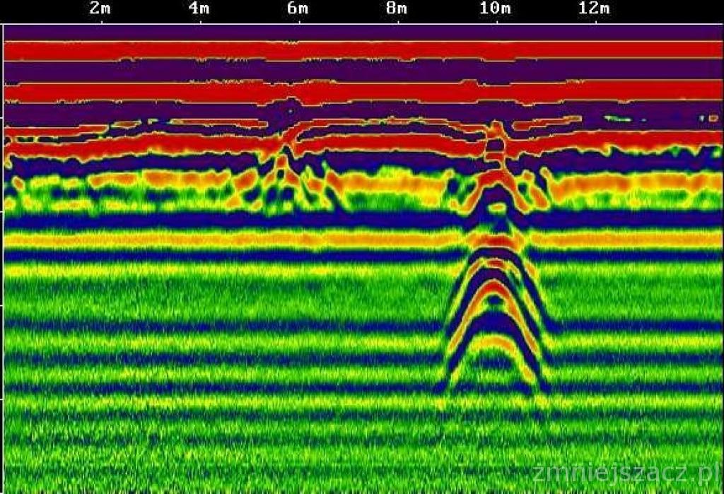
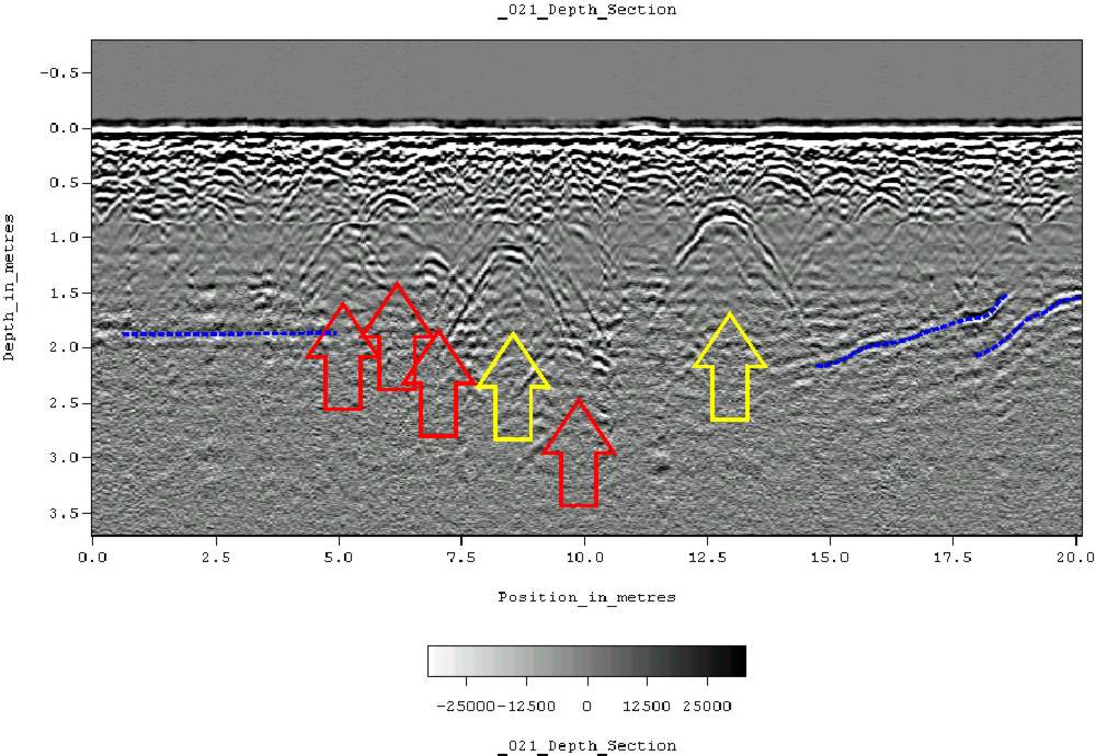
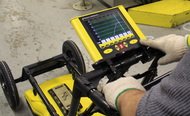
Accurate location and identification of underground pipes, cables, and other buried infrastructure
Detection of voids, cracks, and hidden structural elements in roads, bridges, and buildings
Mapping of soil layers, bedrock, groundwater levels, and potential contamination zones
Non-invasive exploration of historical sites and forensic evidence recovery
Evaluation of pavement conditions, tunnel structures, and foundation integrity
Why choose us?
Our advanced GPR technology ensures highly detailed and accurate subsurface imaging
Non-destructive testing reduces excavation risks while maintaining superior data quality
Suitable for utility detection, construction, archaeology, and environmental studies
Other services
Copyright 2024 | NORDGEO Surveys | All Rights Reserved